|
|
| (3 intermediate revisions by the same user not shown) |
| Line 1: |
Line 1: |
| − | {{Place/sftmap | + | {{Place |
| − | | city = San Francisco
| + | |latlong=37.80121, -122.39809 |
| − | | neighborhood =
| + | |city=San Francisco |
| − | | website = http://www.exploratorium.edu/
| |
| − | | latlong = 37.80121, -122.39809 | |
| | }} | | }} |
| | | | |
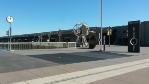
| − | [[File:Exploratorium.jpg|300px]] | + | [[File:Exploratorium 2.jpg|300px]] |
| | | | |
| | __TOC__ | | __TOC__ |
| Line 12: |
Line 10: |
| | {{col1}} | | {{col1}} |
| | ==Historic streetcar== | | ==Historic streetcar== |
| − | [[F-Market & Wharves]] line has stops along the Embarcadero at:
| + | {{Street rail}} |
| − | | |
| − | * {{show streetstop}}
| |
| − | | |
| − | The streetcar line continues south to the Ferry Building and downtown on Market Street. [[E-Embarcadero]] line provides special event service to Caltrain.
| |
| | | | |
| | ==Ferries== | | ==Ferries== |
| Line 26: |
Line 20: |
| | | | |
| | {{col-end}} | | {{col-end}} |
| − | ==Bus - Muni== | + | ==Bus== |
| | Bus stops are located within a few blocks from the museum: | | Bus stops are located within a few blocks from the museum: |
| − | {{#ask: [[Place::Jackson Square Historic District]] [[Provider::Muni]] | + | {{Morebus|show=[[Place::Jackson Square Historic District||Levi Plaza||{{PAGENAME}}]]|notcollapsed provider=Muni}} |
| − | | format=template| link=none| template=listlines2| ?rnum=| ?rlet=| ?to=| sort=rnum,rlet | |
| − | }} | |
| − | | |
| − | ==Other bus==
| |
| − | [[Golden Gate Transit routes|Golden Gate Transit]] (to/from North Bay) - weekday service only: {{#ask: [[Place::Levi Plaza]] [[Provider::Golden Gate Transit]]
| |
| − | | format=list| link=none| template=listlines6| ?rnum=| ?rlet=| ?to=| sort=rnum,rlet | |
| − | }} | |
| | | | |
| | [[Category:Museums]] | | [[Category:Museums]] |
Latest revision as of 07:51, 19 April 2024
Loading map...
{"minzoom":false,"maxzoom":false,"mappingservice":"leaflet","width":"auto","height":"350px","centre":false,"title":"","label":"","icon":"","lines":[],"polygons":[],"circles":[],"rectangles":[],"copycoords":false,"static":false,"zoom":15,"defzoom":14,"layers":["SFTransit","HERE.Transit","HERE.Aerial"],"image layers":[],"overlays":[],"resizable":false,"fullscreen":false,"scrollwheelzoom":true,"cluster":false,"clustermaxzoom":20,"clusterzoomonclick":true,"clustermaxradius":80,"clusterspiderfy":true,"geojson":"","clicktarget":"","imageLayers":[],"locations":[{"text":"","title":"","link":"","lat":37.80121,"lon":-122.39809,"icon":""}],"imageoverlays":null}
City: San Francisco
Directions
to and
from Exploratorium.
Historic streetcar
Market & Wharves: (Historic Streetcar) 17th St and Castro - Fisherman's Wharf via Ferry Building
The nearest stop(s) at:
 Embarcadero & Broadway, Embarcadero & Green, Embarcadero & Greenwich
.
Ferries
The Ferry Building (with service to Oakland, Alameda, Larkspur, Vallejo) is less than 1/2 mile south of The Exploratorium.
BART, Muni Metro
The nearest stop for BART and Muni Metro is the Embarcadero Station, slightly more than 1/2 mile (9 blocks) south of the Exploratorium. F-Market & Wharves historic streetcar also provides connection between BART/Muni Metro and Exploratorium.
Bus
Bus stops are located within a few blocks from the museum:
Mill Valley (E Blithedale and Tower) - San Francisco
Sleepy Hollow/San Anselmo - San Francisco
East Petaluma - San Francisco
Santa Rosa - San Francisco via Rohnert Park and Cotati
All-nighter: San Francisco Zoo - Fisherman's Wharf
Folsom: Valencia & Caesar Chavez — Jackson Street & Van Ness
